


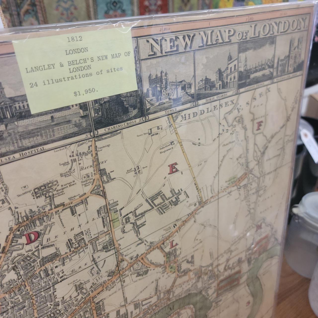
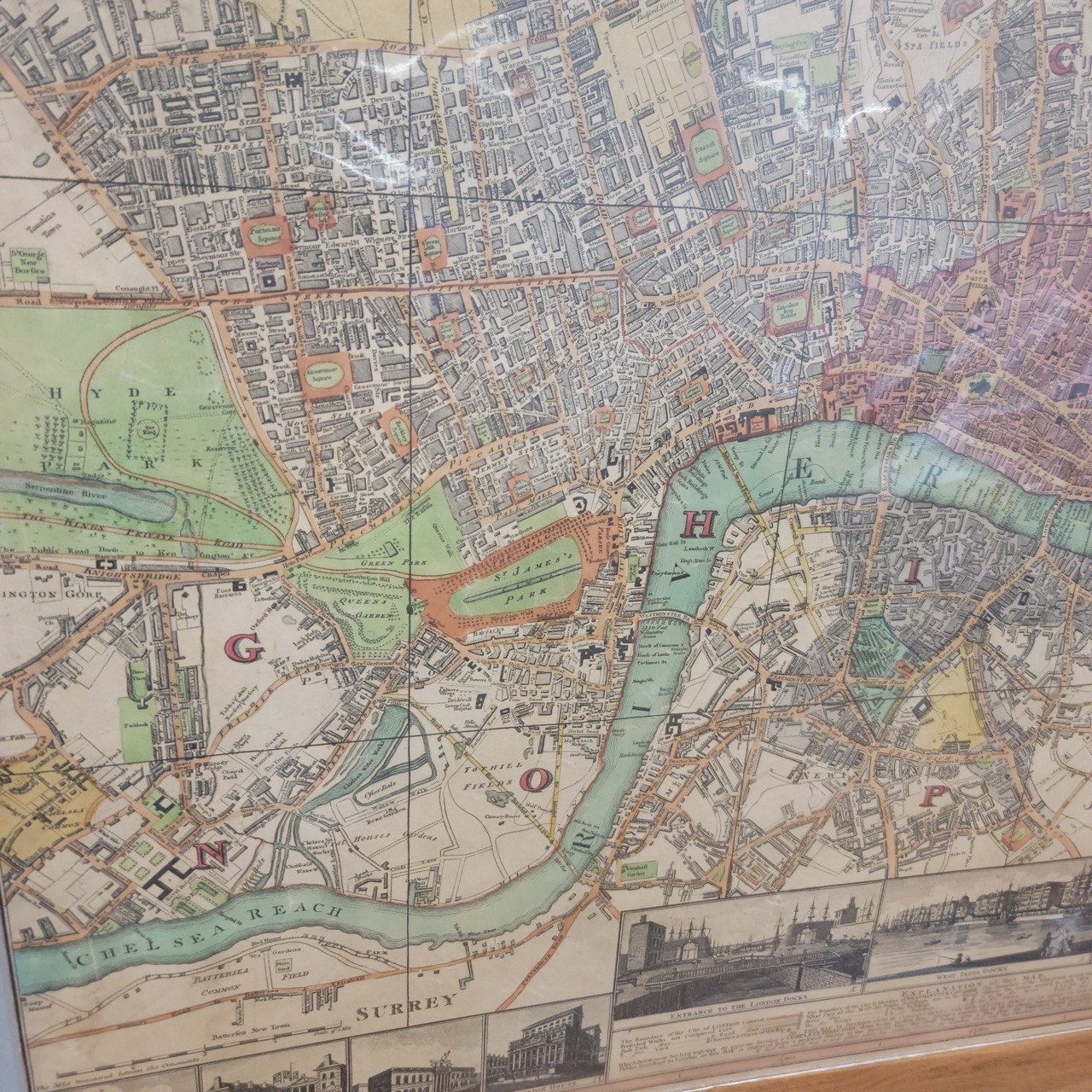
Description
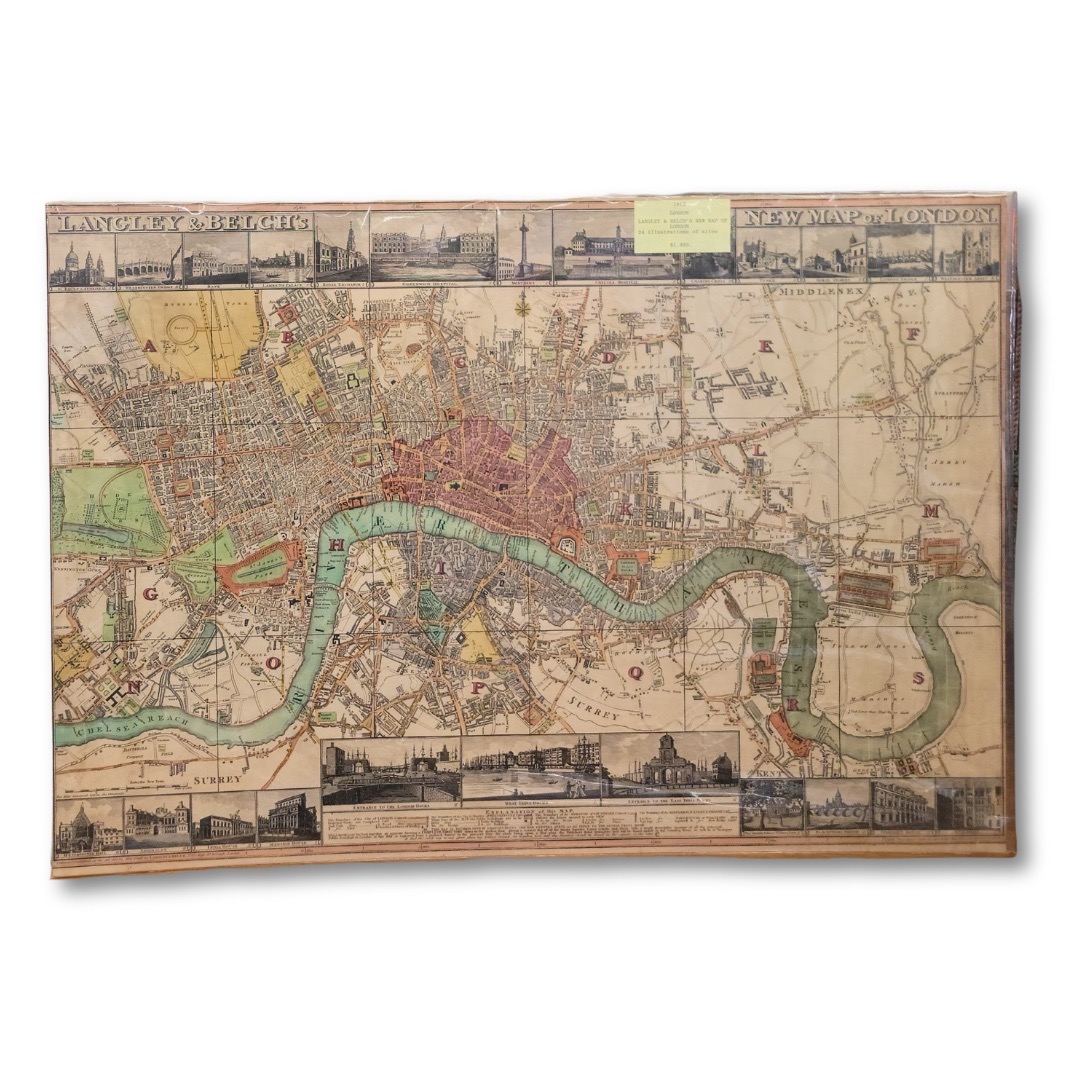
This map captures London at a pivotal moment, just as the city was expanding beyond its medieval core and beginning to resemble the modern capital we recognize today.
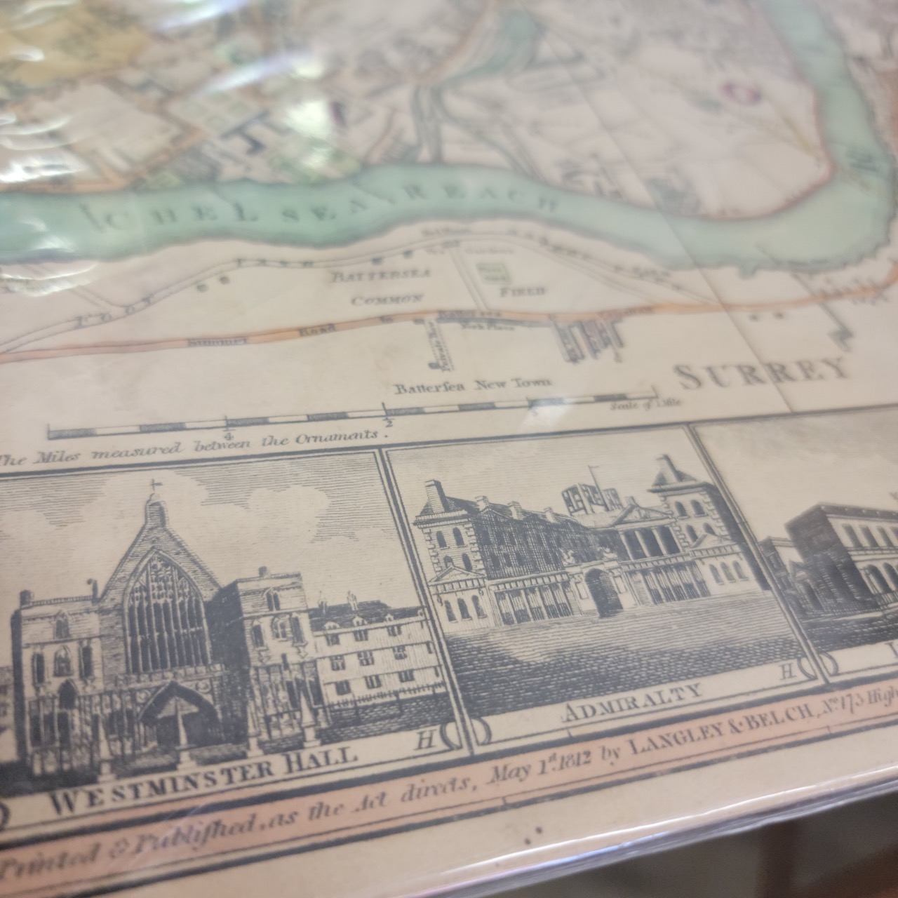
Published in 1812 by Langley & Belch, this New Map of London presents a finely detailed view of the city and the winding course of the Thames, surrounded by engraved vignette illustrations of important civic and architectural landmarks. Westminster Hall, the Admiralty, bridges, docks, and prominent buildings are rendered along the margins, grounding the cartography in lived urban experience rather than abstraction.
The hand-colored layout balances density with legibility, streets, districts, and open spaces carefully delineated, offering both historical insight and strong visual rhythm. Even at a distance, the map reads as architectural texture. Up close, it rewards slow viewing, revealing street names, districts, and planning decisions that shaped London’s future.
In a Mythic Modern interior, this piece functions as more than decoration. It is a cultural artifact, a record of how cities evolve, how power concentrates, and how infrastructure leaves permanent marks. Ideal for studies, libraries, offices, or any space where objects are chosen for meaning as much as beauty.